
About Garu-Tempane District Assembly
Brief History of the District
The Garu-Tempane District Assembly was established by the Local Government (Garu-Tempane District Assembly) (Establishment) Instrument, 2004 (L.I. 1769).
Garu-Tempane is one of the Thirteen (13) districts in Upper East Region. It was carved out of the former Bawku-East District of the Upper East Region of Ghana in the year 2004.
Politically, the District has Two Constituency, 30 Electoral Areas, 9 Area Councils and 30 Unit Committees.
VISION OF THE ASSEMBLY
‘To become a highly professional Local Government Institution that creates opportunities for all, especially women and the vulnerable to effectively participate in decision making process, and human resource development in partnership with other public sector organizations and the private sector’.
MISSION STATEMENT
The Garu-Tempane District Assembly exists to improve the Socio-economic condition of its people by mobilizing the necessary human and material resources in an efficient and effective manner towards developing the District in a sustainable manner.
Political and Administrative Structure
The Garu Tempane District Assembly is made up of forty-six (46) members including the District Chief Executive. This is comprised of thirty (30) elected Members, fourteen (14) Government Appointees and two Members (MPs). There are Six (6) female Members and thirty-nine (39) male Members in the Assembly. Only two (2) out of the thirty (30) elected Members are women whereas Four (4) women are appointed. The District is made up of Two (2) constituencies; namely Garu and Tempane Constituencies.
The sub-structures of the Assembly consist of nine (9) Area Councils, thirty (30) electoral areas and one hundred and fifty (150) unit committees.
The Presiding Member, who is elected among the Assembly Members, chairs the Meetings of the Assembly. He also chairs the Public Relations and Complaints Committee which investigates complaints from the public against staff and Members of the Assembly.
The Assembly which has deliberative, legislative and executive functions is the highest political and administrative body in the District.
The Executive Committee is chaired by the District Chief Executive, and Exercises executive and co-ordinating functions over the Assembly. The Statutory Sub-Committees as stipulated in Act 462, include,
Development Planning,
Social Services, Works,
Finance and Administration, and
Justice and Security.
They collate and deliberate on issues relevant to their functional areas and recommend some to the Executive Committee for further deliberation and submission to the general Assembly for approval.
Apart from the five (5) Statutory Sub-Committees, the Assembly has created three (3) more Sub-Committees namely;
Environmental,
Education, and MSE.
For Administrative effectiveness, the District Chief Executive (DCE) is supported by a bureaucracy headed by a District Co-ordinating Director (DCD) who reports to the DCE and is in charge of the day to day running of the Assembly’s bureaucracy.
The District Co-ordinating Director, co-ordinates all the activities of the Departments of the Assembly and ensures that policies and programmes of the Assembly are effectively implemented.
Location and land size
The District is located in the South Eastern corner of the Upper East Region of the Republic of Ghana. It shares boundaries with, Bawku Municipal to the North, Binduri to the North West, Pusiga District to North East, East Mamprusi District to the South West, Bunkpurugu-Yunyoo District to South East, Bawku West District to the West and the Republic of Togo to the East.
It covers an area of 1,230 Km2. It lies on approximately latitude 10o 38lN and110N and longitude 0o 06l E and 00 23l E.
The 2010 population and housing census gave a District Population of 130,003. The male population in the District is 62,025 representing 47.7 percent of total population while that of the female population is 67,978 also representing 52.3 percent. An exponential projection using the district growth rate of 1.37% gives a figure of 135,467 disaggregated into 64,632 males and 70,835 females as the 2013 population and is expected to be 143,111 thus 68,279 males and 74,832 females by 2017.
The location of the District makes it easy for inter-District, Inter-Regional and International Trade between the Republic of Togo and Northern Region of Ghana. The advantage of the District location is its access to Togo and Northern Region. Easy trade between the people of Togo, Northern Region and our traders result in relative cheaper imported goods and services such as mobile phones, satellite dish and accessories, motor bikes, cloths and animals such as cattle, sheep and goats. Traders in Garu Attends Gusheigu market in the Northern Region and supply the District with relatively cheaper farm produce such as yam and cereals.
The location of the District puts it at advantage as well as disadvantage in position. It is far remote from the Regional and other District Capitals in the Region. It costs money and time to transact business at the Regional level. The fact that it shares boundaries with Togo results in cross-border crime and other social vices. This can make prevention of HIV/AIDS difficult in the District.
Currently the inter districts and international road network is very poor. Fortunately, the Eastern corridor road is to pass through the District and that would further boost trade between the District and Southern sector. It is anticipated that when the road is constructed it would increase our internally generated funds (IGF) and also boost the transport business in the District.
The District shall collaborate with other 6 neighbouring districts and Republic of Togo to improve on the inter districts and international roads to ensure free movement of goods and services.
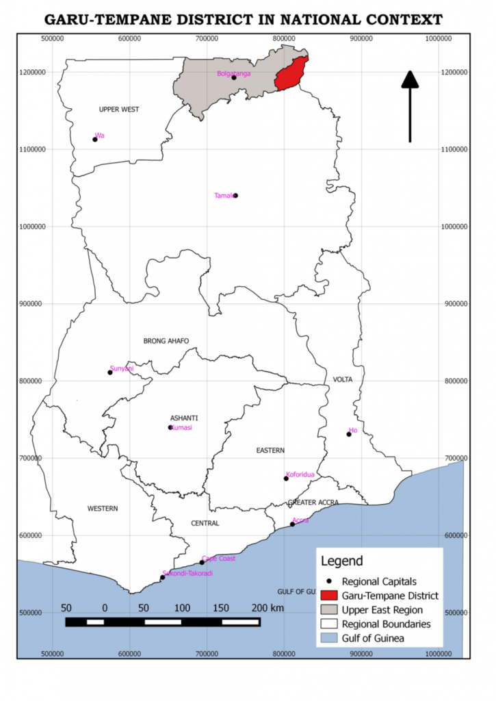
Location on Map


Relief and Drainage
The District forms an extension of the Gambaga scarp and is underlain mainly by birrimian and granite rock formations separated in parts by thinly to moderately bedded sandstones. The relief of the District easily marks the highest point of the Upper East Region. With regards to areas that borders the White Volta and its tributaries the relief is generally low and slightly undulating with heights of 120-150 metres above sea level. The rest of the District consists of a series of plateau surfaces. The average height of the plateau is 400 metres above sea level, but isolated peaks rise beyond 430 metres.
The White Volta and its tributaries are the most significant of which the Tamne drains the District. The others are Pawnaba-Kiyinchongo streams. These rivers have strong irregular seasonal flow patterns. They flow from June to December with peaks in August and September. During the wet season they flow excessively followed by recession and low water levels during off seasons. The water from the rivers supports onion, water-melon and vegetable cultivation in the dry season.
Except in a few areas around the river basins where the drainage becomes poor because of seasonal flooding, the area is generally well drained. This provides a suitable environment for both agricultural development and human settlement. One major challenge affecting these rivers is siltation resulting from cultivation along the banks. Public education against this practice and planting of trees along could help sustain the life of the rivers.
1.1.3 Climate
Garu-Tempane is part of the interior continental climatic zone of the country characterised by pronounced dry and wet seasons. The two seasons are influenced by two alternate air masses. One of them is the cold, dusty and dry harmattan air or the North East Trade winds which blows mostly from late November to early March in the north-eastern direction. During that period, rainfall is entirely absent and humidity is very low, sometimes less than 10mm and relative humidity rarely exceeds 20 percent during the day but may rise up to 60 percent during the night and early morning. Temperature is usually modest at this time of the year by tropical standards (260-280 C). Between March and May temperatures could be as high as 380C.The highest mean monthly temperature is 400C, which occurs in April while the lowest temperature of 180 C occurs in December/January. There is plenty sun shine in the area which can support solar energy development. There are also potentials for wind mills which can be used for irrigation purposes. The period is characterised by such human and animal diseases such as CSM, Anthrax, and Newcastle etc.
The second air mass laden with moisture from the Atlantic Ocean blows between May and October. During this period the area comes under the influence of the deep tropical maritime air mass. The air mass, together with rising conversion currents, provides the District with rains. Total rainfall amounts to an average of 800mm per annum.
During this period (May to October) the rainfall is torrential, unpredictable and unreliable. The large quantity of rainwater is normally lost through evapo-transpiration from open surfaces partly due to the bare and dry nature of the ground. This affects availability of water for agriculture and domestic consumption. It is estimated that a volume of between 1.55 to 1.65 cubic metres per square area of the rainfall is lost per annum. Rains during this period of the year support the on-season cultivation of the major food and cash crops in the District.
1.1.4 Vegetation.
The vegetation of the District is mainly of the Sahel savannah type, consisting of fire swept grassland separating deciduous trees among which can be seen a few broad-leaved species. The most densely vegetated forest reserves include: Denugu, Siisi, Kpatua, Nakinting, Kariyata and Wakpesi. Other isolated places are Karateshie and Tarivargo forest reserves. This vegetation supports livestock development in the area. It also contains some economic trees like shea and dawadawa which support livelihoods in the area.
There are also some medicinal plants. A cursory look at the vegetation portrays on uncontrolled destruction of the environment for livelihood activities. The effects of this is that uncontrolled destruction of some of these trees are gradually fading out, this affects livestock, livelihood production and the destruction of biodiversity. There would be the need to revive community environmental committees or other community action groups to see to the rejuvenation of the vegetation cover.
Geology
The oldest rocks of the north-eastern part of Ghana are those of the pre-Cambrian basement complex. The basement is made up of granite, exposed over the western and northern parts of the District as tabular hills.
Hydrology
In the basement complex, ground water is found in weathered mantle in abundant quantities. The quality of ground water from the basement complex makes it ideally suitable for drinking and irrigation purposes. It is therefore not difficult to drill boreholes or construct dams in the area.
Soil
The District is covered with three main soil types:
- a) Red and brown sandy loam and clays associated with horn blended granular.
- b) Moderately deep, pale brown coarse sandy loams associated with biotitic granites.
- c) Gray sandy loams and clays in river valleys.
- d) These support a variety of crop production in the District, mainly cereals and legumes. These soil types can also support brick and tile and pottery industries.
Minerals
There are limestone deposits in the western part of the District notably in the Worikambo area. This could be exploited for the manufacture of paint and chalk. There are also clear signs of diamond deposits.
Conditions of the Natural Environment
The natural environment over the years has been degraded. The vegetation cover has been reduced, the Surface water in the dry season is also limited.
Indiscriminate felling of trees for charcoal and farming activities have impacted negatively on the environment. Other negative environmental practices in the District are:
? Bush burning.
? Bad farming practices leading to soil erosion, siltation of water source and leaching.
? Overgrazing by animals.
? Gravel winning.
? Pollution of the water bodies.
Many of these also constitute the principal causes of disasters such as floods, draughts, outbreak of plant and animal diseases in the District in addition to wind and rainstorm. Drastic measures need to be put in place to safeguard the environment.
Built Environment
The built environment consists of housing, which is mostly made of switch in the rural areas, and block houses in the urban and other big settlements. There are also markets and other socio-economic infrastructure. However, apart from the Garu Township there are no layouts in other communities. This promote haphazard development even in Garu Township where there is a layout. This is partly because there is no functional statutory planning committee. There are also some protected forest reserves and community forests.
Social and Cultural Structure
The predominant ethnic groups in the District are Kusasis, Busangas, Mosis, Bimobas and Mamprusis. Apart from that there are quite a number of migrants from other parts of the country, especially the south, and neighbouring countries of Togo and Burkina Faso.
Annual festivals are observed in the District. The festivals are celebrated by the different ethnic groups at the beginning of the harvest or after the harvest season. On these occasions, apart from merry making, traditional sacrifices are made to the gods of the land. This is done in acknowledgement of their blessings in the past and to implore their help and protection for the future.
The most widespread festivals of the District are the Samanpid of the Kusasis, Ziisar of the Kusasis and Bimobas and the Danjuar festival of the Bimobas.
Traditional marriage entails the distinctive practice of payment of a bride-price; the system where the family of the bridegroom meets some marriage expenses including the payment of 2 or 3 cows to the family of the bride. This practice is a prerequisite for all marriages in the District and can therefore be preceded by other forms of marriages but cannot be compromised by any other form. This practice of paying bride price, however, has led to so many hardships in many families and has even contributed to broken homes where indebtedness or debt servicing situation lasts for long periods. The temptation to withdraw female children from school to give up for marriage has had a serious toll in contributing to high school dropout among girls. It also discourages the youth from marriage which is a recipe for promiscuity.
The dominant religions are Islam, Christianity and Traditional African Religion. There are also some few nonbelievers.
Economy
Agriculture is the dominant occupation of the people of the District. Women and men play almost the same roles in farming activities in the District. The major crops grown are maize, millet, groundnuts, onions and watermelon. Livestock such as pigs, cattle, sheep and goats are also kept by farmers. Poultry, especially guinea fowls production, is quite significant.
The long dry season coupled with the inadequate number of irrigable dams contribute to the migration by the youth of the District to the southern sector of the country during the lean season in search of menial jobs. Other areas that offer employment to the people are public service, food processing, textile and leather works, and retail/whole sale.